 vesseltracker.com
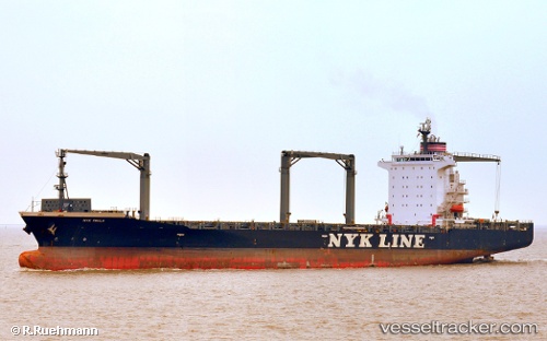
Vessel Nyk Paula IMO: 9419632, MMSI: 356629000 Container Ship
UTC, 10.24333, 102.40833, course: -1, speed: 13
UTC, 9.91833, 102.64500, course: -1, speed: 13
2026-03-09 20:10:05 UTC, 9.52167, 103.03167, course: -1, speed: 13
Live Vessel Nyk Paula Analytics (details, animations, etc.)
Live AIS position: UTC. 42 nm N of Dai Hung (STS Load)), updated 2026-03-09 20:10:05 UTC.Find the position of the vessel Nyk Paula on the map. The latter are known coordinates and path.
marine traffic ship tracker show on live map
The current position of vessel Nyk Paula is 9.52167 lat / 103.03167 lng. Updated: 2026-03-09 20:10:05 UTCCurrently sailing under the flag of Panama
Nyk Paula built in 2009 year
Deadweight:
34532 tDetails:
Last coordinates of the vessel:
UTC, 10.49667, 102.22333, course: -1, speed: 13UTC, 10.24333, 102.40833, course: -1, speed: 13
UTC, 9.91833, 102.64500, course: -1, speed: 13
2026-03-09 20:10:05 UTC, 9.52167, 103.03167, course: -1, speed: 13